Showing posts with label Scotland. Show all posts

Sunday, January 20, 2013

Aberdour Village

A fanciful signpost at Aberdour's station.
September 2012 after St. Cuthbert's Way.  We made our way via motor coach and train to the village of Aberdour and the hotel of the same name.  Pat, Tina, Helen and I had stayed several years ago after our Speyside hike.  I fell so in love with the town that I dreamed about staying on until my bank account was drained.  So here we were, again, in this little town.  So far as I can tell, it has no grocery store, one convenience store, a postoffice that's in a dusty second-hand bookshop.  It has a library/town hall, a large lawn bowling fields, a tea shop, and two hotels.  I think there's more of the town that stretches eastward (?) along the road but I've not travelled that far.

No, what made this town so appealing were the two beaches, the tiny harbour, the stationmaster at the village station.

Stationmaster first.  His name is Trevor.  Years ago that was all we knew.  He was very helpful and very interested in our comings and goings.  He certainly did more that just sell tickets.  We'd planned to visit the Falkirk Wheel and do some walking at the same time.  Trevor said we could take the train, walk along a canal to the wheel, take a ride, walk back up the hill and through a tunnel to the other canal, walk from there to the next tunnel, which we'd avoid by going down the stairs to a different train station.  Or something equally complicated.  Anyway, it all worked, we rode the trains, walked the canals, climbed the hill, and had a whirl in a boat on the wheel.

Trevor, it seems, has become famous.  His villagers nominated him for an MBE, a Queen's Honour, and it was awarded to him in June.  http://www.forthone.com/news/scots-make-the-queens-birthday-honours-list/
To say he was excited and thrilled, even three months after receiving the award, is quite an understatement.  What made it special to him is that it was an award initiated by his friends in the village.


So here are some of my photographs; there may be lots and lots of the Black Sands beach because of the drama between high tide and low tide.

But first:  Trevor Francis and his station.

Here he is, working away on his day off (!!) and as friendly as ever.  Yes, he remembered the four American women, even though two of us (Barbara and Sandy) were not the originals.  And once again he gave us good advice for travelling to various nearby places, including how to get to Edinburgh's airport without going into the city.


And his train station, with the Victorian cast iron columns and decoration beneath the eaves, the flower boxes and hanging plants and hillside across the track filled with all shades of green foliage.

Trevor keeps the station  in good order,
does all the painting, cleaning,  maintenance,
all the while suffering from arthritic knees.  
He has a small greenhouse nearby and tends to
all of the hanging baskets and plants himself.
The hotel is three stories high, rooms on the upper floors,
dining room and public bar on the ground floor,
and more rooms in the old stable/laundry.
It's an 18th century building., so we were told.

One of the brief commercial strips in the village.

The green one is a shop selling handmade things, from jewelry to knicknacks.

A very important-looking house, set back as it is.
But not forbidding:  the gate was always open.

Homes along the road to the harbour.  Most all buildings are
constructed of stone - in ample supply in Scotland.

If memory serves, this is the Aberdour Boating Association.
To me it looks more like a  movie set for a film about gremlins or goblins.

Boats in the harbor, at high tide.  What's the body of water?
Why, the Firth of Forth.  We are across the Forth
from Edinburgh, more or less.
Same boats, same harbor, but at low tide and from the opposite seawall..
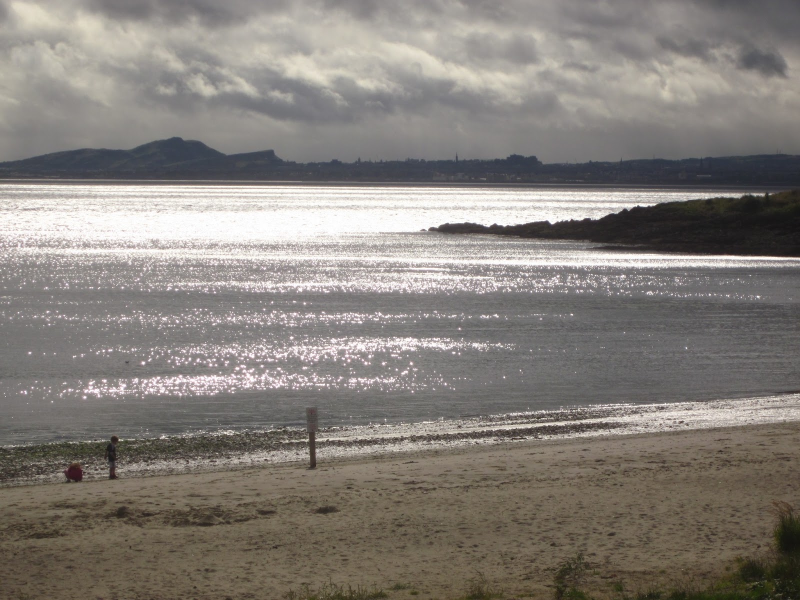
Looking to the East from Black Sands beach at high tide.
Same view as above, but at low tide, and I backed up a bit.
See why it's called Black Sands?

The islands on the horizon house an abandoned WW II lookout
and ruins of a medieval abbey.
Beyond, on the other side of the  Forth is Edinburgh.
Farther along the Forth is the Silver Sands beach - -
well, the black rocks are gone but a sign warns of soft sands.
Silver Sands has a car park and tables, benches, and a modern cafe..
Sandy is wearing the hat; Pat is sitting down.  Barbara is somewhere,
probably taking some very nice photographs.  She's good at that.
Most of our dinners were eaten in the bar.  It's very cozy and friendly.
The bartender is very helpful (and is the owner,
with his wife).  Quite nice, quite comfortable.

On the last morning, there's a rainbow to see us on our (very wet) way.


Thursday, November 1, 2012

Edinburgh Castle

The ancient city of Edinburgh, Scotland was built upon an extinct volcano.  The skyline is dominated by the Royal Mile which begins at Holyroodhouse Palace and rises a mile or so to terminate at Edinburgh Castle.  After our week hiking St. Cuthbert's Way, my friends and I removed to a small hotel in a lovely village on the Firth of Forth and made a day trip just to visit Edinburgh Castle.
Here are some photographs from that visit.

The mile-long street between the Castle and Holyroodhouse Palace is the Royal Mile.  The upper end of the street is Castlehill.

This photo was taken after we'd left the Castle - in the rain.  Hence the overcast appearance.  Typical UK weather: sun, clouds, rain, all in just one afternoon.

This is the  Esplanade - large parade ground outside the Castle gates.  In  August is the famous Military Tattoo, which we'd just missed by a few weeks.

At the (19th century) entrance are statues of Scotland's great heroes, Robert the Bruce on the left and William Wallace on the right.  The statues, I'm told, were made in the 1920s.

Far below the Castle and to the North, in the so-called New Town (really new in the 18th century), is Princes Street, now a major shopping street in the city.

Between the Castle and Princes Street lies Princes Street Gardens, where once was a lake.  Beyond in the far distance is the "Kingdom of Fife" and between there and Edinburgh is Firth of Forth.  A firth, I'm told, is a river estuary.  I hope that's true.

This very high arch connects the Scottish War Memorial (left) with the Royal Palace (right).  

This palace was the residence of the Stewart kings and queens in the 15th & 16th centuries, the birthplace of King James VI in 1566 (later James I of England), and the home of the Scottish crown jewels.

The facade of the Royal Palace.  Together it forms a great square, with the Great Hall, the  Scottish United Services Museum, and the Scottish War Memorial.

Inside the Great Hall, a beautiful 15th century hall lined with medieval weapons, we found this quartet wearing period clothes and playing period music on period instruments.  This happens only once monthly; we were very lucky.

The walls of the Great Hall are lined with weapons like these swords and claymores, also with shields, pistols, mortars, pikes, axes, and some several suits of armor.  Also with the coats of arms of many clans.

These are the steps into the Scottish  War Memorial, where no photographs were allowed.


St. Margaret was a queen of  Scotland in the 12th century, known for her  virtue, goodness, and generosity.  She's a patron saint of Scotland (which seems to have more than one), and this window is in the very tiny St. Margaret's Chapel

The building with the zig-zag roof is now a restaurant, and to the right of it is the famous One O'Clock Gun - - not 12:00 or any other hour but 1:00 pm to inform pre-wristwatch citizens of the hour.  Scots have a reputation for frugality: one gun shot is cheaper and easier than booming away 12 times.  

The Castle is very hilly and rocky; many of the connecting paths are steps and many are curved, like this one.

Inside the Casemates is this section recreating where prisoners of war lived - from the Seven Years War up through the Napoleonic Wars and the War of 1812.  Note:  During the American Revolution, colonial captives were not well treated because they weren't considered soldiers but rather traitors and held as common criminals.

Barbara is trying to capture what an individual person's surroundings  were.

Prisoners of war were allotted pease, bread, cheese, and [not shown here] 2 pints of ale daily.

Uniform of a French Officer - - contrast this colorful and elegant coat with contemporary camouflage uniforms.

Emperor Napoleon's regiments carried at their head an imperial eagle, with the regiment's number at the base.  The design was supposed to be Roman.  This eagle was taken during the Battle of Waterloo, June 18, 1815, by a Sargeant in the Royal Scots' Greys, a cavalry unit.

The Standard of the French Imperial 45th Infantry Regiment whose eagle is just above.

I very much liked reading this description of the battle scene when the Imperial Eagle was captured by the Scots Grey.

We left the Castle by passing through this, the Portcullis Gate, and into the  Royal Mile.


Night is coming; Castle is closing; we'll walk down the Royal Mile, find some place for dinner, and take the train back to the little village of Aberdour.  What a nice day it was.


Tuesday, October 2, 2012

St. Cuthbert's Way

Four friends took a wonderful seven-days walk in mid September.  It was 62 miles long, through the Scottish Borders.  The route was probably an old pilgrimage route from medieval days - - we passed several former monasteries or abbeys that had been ravaged by time after Henry VIII ordered them closed in the 1540s.  We walked from West to East, from Melrose to Holy Island - from Melrose Abbey to Lindesfarne Abbey.
The walk is named after a 7th century saint. Cuthbert was a native of the Borders who spent his life in the service of the church. He began his work at Melrose Abbey. He achieved the status of Bishop, and when he died he was buried on Holy Island. He was called a saint eleven years after his death, when his coffin was opened and his remains found to be perfectly preserved.
Here's a pictorial history of the walk, which  is called St. Cuthbert's Way [SCW]:


The "official" beginning of the SCW is the churchyard gate at Melrose Abbey


This is Melrose; we spent 2 mights here - most of the towns where we stayed looked like this: 2-3 story buildings, made of stone, several centuries old, ground floor shops, flats above, narrow streets. Melrose Abbey is a popular attraction, managed by Historic Scotland (I think) and so it's a bit more crowded and up-to-date than some others.


We walked and hiked and climbed up and up.   The Eildon Hills (rather steep) were the first obstacles, not very high, fortunately.   Barbara's looking down at how small the town appears.

Salmon fisherman in the Tweed River.  The SCW follows this for about 2.5 very large bends.  It had been suggested that permits to fish the Tweed for salmon are very expensive, which may explain why the river wasn't full of fishers.


The Roman helmet signifies that we are now on Dere Street, laid out by Roman army 2000 years ago.  On the map it is a straight line of a mile or two.  In reality it wiggles and twists and is overgrown with long wet and annoying grass.  That's Pat pointing out something.


These are outbuildings from a very large estate.  They've been converted into an arts center, children's enrichment center, tea room, art gallery, visitor center.  It's called Harestanes and we enjoyed the tea room while awaiting the taxi to carry us to our B & B.
Here is what sheep do.  They munch and munch, heads down on the grass.  When one sees me, it stares, motionless.  When I raise my camera, it hightails it away.   And all the rest follow suit.  Every one of them.  All running away.


This was a milestone not to be forgotten.  It always felt like bigger hills and that the end would never come.  The prior photograph shows us struggling to keep the constant wind from tearing off hats and chilling hands.  Blessedly, the wind was at our backs.


To American ears, these names seem (to be kind) odd.  Would I choose to live in a place called Sourhope?  too depressing.  And what would be the derivation of Cocklawfoot?  At least, Belford on Bowmont would be different from, say, Belford on Tyne or Belford on Thames.

Dogs in the pub were common.  This fellow sat or lay, bored, the entire time we were there.  Pub food seemed to be fairly uniform:  steak and ale pie, fish and chips, roast lamb shank. chicken curry.  Occasionally a treat:  seared salmon; lamb loin chops.  My personal favorite was also a one-off:  Trawler pie (like shepherd's pie but with salmon, prawn, scallops).


A border without border control.  As my son pointed out "You are on the right side of the border."  And I think this was my 72nd birthday but wasn't sure.  Time didn't seem the same without clocks everywhere.


The footpath led through many tree plantations.  This pine plantation surrounded St. Cuthbert's cave, a very minor but physically large attraction.

St. Cuthbert's cave is a large "room" on the hillside, beneath monstrously big limestone boulders.  Without a flashlight, I didn't explore.  We were greeted by the Ramblers who had passed us every day (being British, they don't poke along), and who were "killing time" until time to meet their van in the next town.

To get to this point - on a chilly and damp morning-  we crossed a highway, through fields and along farm roads, across a very busy train track, a stream and then a field, and eventually here.  The end is in sight.  The causeway is to the right of the signs.  My great fear was that we would miss low tide and have to wait six hours to cross.  We made it.


In earlier years (pre-causeway) pilgrims walked across the sands, like these two.  Poles mark the way.  Somewhere out there is a "refuge" - small room elevated about 12 feet above the sand.  We did NOT walk the sands.


The village of Holy Island and our hotel - large white bldg. behind the red roofed one - are just beyond the small harbor.  The castle of Lindesfarne stands on a very high rock (part of an extinct volcano?) behind the photographer.


Here's the same harbor from the hotel's lawn, and that's the Lindesfarne Castle high atop its dark rock.  Looks forbidding, doesn't it.
This bus runs once weekly in September and every 10 days in the next six.  The only time it runs daily is in Tourist Season.  It took us to Berwick where the next adventure began with buying a bus ticket in a train station.  It seems the train doesn't run on weekends because of track work (Oh, shades of Washington's Metro!) 

And that was the end of our too-fast visit to the Scottish Borders. I'd love to go back and revisit some of the towns, the moors and, yes, even the hills. It was very tiring but also very exhilarating and I have good feelings about having done this.