Tuesday, November 6, 2012

Halfway finished, and across a border

By September 12 (my birthday), we were more than halfway to our destination, and today would mark the crossing from Scotland into England.  Historically, especially before the two kingdoms, England and Scotland, were united in 1603 under James VI of Scotland and I of England, there had been near constant conflict between the two.  This hilly area is now so peaceful, but there was a suggestion in a hotel restaurant that the English and Scots still don't like each other.  They are close neighbors, their food and beers and ales taste the same (to my American tongue).  But the comments of the English couple at the table next to me made me uneasy.  In any event, here are more photos from St. Cuthbert's Way.


At the border:  no customs officials, no border guards, no bureaucracy.  Just a stone wall , some barbed wire, and a wooden signpost out in the wide open sky.

Occasionally the footpath went into a forest, a plantation, really, of evergreens - - very dark and gloomy.  Made me wish for a helmet light like spelunkers wear.

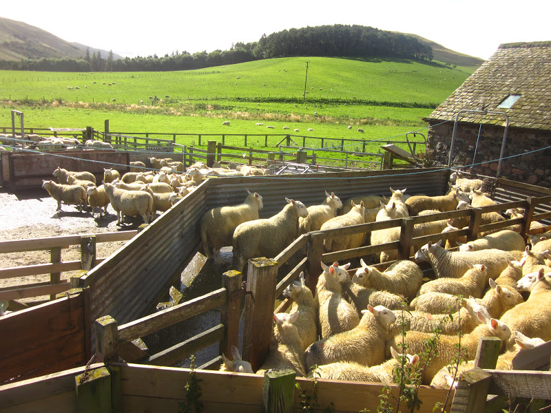
Back in the sunshine, this creature looked like a guardian.  He was near the sheep dip, where two men were dunking sheep in insecticide.


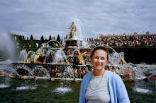
Our English friends, whom we first met in Jedburgh after a fiercely stormy night.  

When I first saw golden sheep, I thought it was a special breed.  Turns out they'd just been through the sheep dip.

This large fellow up among the thistles was, we thought, a feral goat.   He certainly was large, shaggy and very handsome.  And I was happy that he kept his distance from us.

A hillside covered in heather.  An amazing sight.

Heather plants are hardy and woody-stemmed.  I'd love to grow lots of it at home, but the climate in Virginia is probably not suitable.

Quite a few of the towns we passed were similar to this:  buildings right at the sidewalk - no yard or lawn.  This is Tisdale House, a B & B where we spent one night.

That bridge is made of brick and stone, it's called Weetwood Bridge, and is a very old listed bridge - which means, I think, that it has historical significance and cannot be changed.
"Flodden 1513" refers to Flodden Field, site of a battle near this bridge, in September 1513 between the Scots and the English.  The reigning monarch of Scotland, James IV, was killed during that battle.  


A handsome gate and gravel drive lead to a large red brick house.

Barbara has found a row of wild blackberries; Sandy appears to be looking for them too.  We found such wild berries  throughout our hike.  September must be their season.

Into a large and well-spaced pine plantation, heading for St. Cuthbert's Cave.

As the rain got heavier, we got closer and closer to the enormous sandstone boulders that formed St. Cuthbert's Cave.

This sign refers to the fact that St. Cuthbert's monks carried his corpse from Lindesfarne (where he died) to Durham to save it from Viking marauders.  The journey took either 6 or 9 years.  And, the legend says that his body was uncorrupted.

Sunday, November 4, 2012

Sept. 10-11 - still in the Borders

These two days were not the longest walks nor were they the shortest.  Mainly they were significant to me because of the occasional proximity to other people - whether farms, towns, or passing us on the way..


Sheep and a farm house or some other building, fallen into pieces in a little valley with a stream running through it.

One of the very good products of Scottish breweries.  Every night I had a different ale or beer.  Not that I know what is the difference.

Out on the loneliness of Cessford Moor Barbara is looking at her map - - are we in the right place? is this the right footpath?  isn't there a signpost somewhere?

Sometimes the footpath was a clearly marked way - created by cows? sheep? a vehicle?

A dry-laid stone wall has no mortar.  That is a sure sign that people have inhabited this place for a long long time.

Sheep everywhere.  Cannot get away from them.  Not necessary: they will run away as soon as I make a move.

Much more domesticated area, with a great variety of lovely chickens, all waiting for someone to feed them.  I think that's why many of them have turned toward me.

That roof is not slate nor shingle.  It is thatched and probably with some kind of reed.   This is in one of the towns called Yetholm - - Kirk Yetholm, I think.

Mobile food - - This truck brings freshly-fried fish and chips to the town green in Yetholm. The man inside is lifting a piece of fish from the HOT oil.  Smelled just great.  I expect to see food trucks in Washington, DC, not in a tiny village in the Scottish Borders.

We could have eaten in the dining room of the Plough Hotel, but the pub seemed so much friendlier and warmer.  And the food came from the same kitchen.

Outside the "Singing Donkey Hostel" (no, we didn't stay there, just passed it on our walk) a clever reuse of worn-out hiking boots.  Very appropriate for this part of the world.
Nearly every day we were passed by a group of about 12 Ramblers (members of a British hiking organization) who were also hiking the SCW.  A bus delivered them each morning and picked them up each afternoon.  Have no idea where they stayed, but it was always good to see a familiar face - even as they "raced" past us.


Thursday, November 1, 2012

Edinburgh Castle

The ancient city of Edinburgh, Scotland was built upon an extinct volcano.  The skyline is dominated by the Royal Mile which begins at Holyroodhouse Palace and rises a mile or so to terminate at Edinburgh Castle.  After our week hiking St. Cuthbert's Way, my friends and I removed to a small hotel in a lovely village on the Firth of Forth and made a day trip just to visit Edinburgh Castle.
Here are some photographs from that visit.

The mile-long street between the Castle and Holyroodhouse Palace is the Royal Mile.  The upper end of the street is Castlehill.

This photo was taken after we'd left the Castle - in the rain.  Hence the overcast appearance.  Typical UK weather: sun, clouds, rain, all in just one afternoon.

This is the  Esplanade - large parade ground outside the Castle gates.  In  August is the famous Military Tattoo, which we'd just missed by a few weeks.

At the (19th century) entrance are statues of Scotland's great heroes, Robert the Bruce on the left and William Wallace on the right.  The statues, I'm told, were made in the 1920s.

Far below the Castle and to the North, in the so-called New Town (really new in the 18th century), is Princes Street, now a major shopping street in the city.

Between the Castle and Princes Street lies Princes Street Gardens, where once was a lake.  Beyond in the far distance is the "Kingdom of Fife" and between there and Edinburgh is Firth of Forth.  A firth, I'm told, is a river estuary.  I hope that's true.

This very high arch connects the Scottish War Memorial (left) with the Royal Palace (right).  

This palace was the residence of the Stewart kings and queens in the 15th & 16th centuries, the birthplace of King James VI in 1566 (later James I of England), and the home of the Scottish crown jewels.

The facade of the Royal Palace.  Together it forms a great square, with the Great Hall, the  Scottish United Services Museum, and the Scottish War Memorial.

Inside the Great Hall, a beautiful 15th century hall lined with medieval weapons, we found this quartet wearing period clothes and playing period music on period instruments.  This happens only once monthly; we were very lucky.

The walls of the Great Hall are lined with weapons like these swords and claymores, also with shields, pistols, mortars, pikes, axes, and some several suits of armor.  Also with the coats of arms of many clans.

These are the steps into the Scottish  War Memorial, where no photographs were allowed.


St. Margaret was a queen of  Scotland in the 12th century, known for her  virtue, goodness, and generosity.  She's a patron saint of Scotland (which seems to have more than one), and this window is in the very tiny St. Margaret's Chapel

The building with the zig-zag roof is now a restaurant, and to the right of it is the famous One O'Clock Gun - - not 12:00 or any other hour but 1:00 pm to inform pre-wristwatch citizens of the hour.  Scots have a reputation for frugality: one gun shot is cheaper and easier than booming away 12 times.  

The Castle is very hilly and rocky; many of the connecting paths are steps and many are curved, like this one.

Inside the Casemates is this section recreating where prisoners of war lived - from the Seven Years War up through the Napoleonic Wars and the War of 1812.  Note:  During the American Revolution, colonial captives were not well treated because they weren't considered soldiers but rather traitors and held as common criminals.

Barbara is trying to capture what an individual person's surroundings  were.

Prisoners of war were allotted pease, bread, cheese, and [not shown here] 2 pints of ale daily.

Uniform of a French Officer - - contrast this colorful and elegant coat with contemporary camouflage uniforms.

Emperor Napoleon's regiments carried at their head an imperial eagle, with the regiment's number at the base.  The design was supposed to be Roman.  This eagle was taken during the Battle of Waterloo, June 18, 1815, by a Sargeant in the Royal Scots' Greys, a cavalry unit.

The Standard of the French Imperial 45th Infantry Regiment whose eagle is just above.

I very much liked reading this description of the battle scene when the Imperial Eagle was captured by the Scots Grey.

We left the Castle by passing through this, the Portcullis Gate, and into the  Royal Mile.


Night is coming; Castle is closing; we'll walk down the Royal Mile, find some place for dinner, and take the train back to the little village of Aberdour.  What a nice day it was.