Thursday, October 3, 2013

Southwest France - end of our hiking

On this, the last hiking day, I slept reasonably well, awakening in darkness at 3:47 am.  What's with that? Back to sleep soundly, until the alarm, at dawn.
Sunrise over Collias
The breakfast here was the best yet.  Not only outside "en plein air," but Marie-Agnes offered good yogurt, the usual croissant and baguette, butter and homemade confiture, but also asked if we'd each like a boiled egg.  The unanimous answer was "Yes!"  She was very sweet and maternal and practical - saying we'd need that protein for our walk.  Of course, she was right.
Boiled eggs kept warm in the bell-shaped covers.
As we walked back through Collias to the trail, we passed a baker kneading bread in his store window,
I would have thought 9:00 was a late hour to be baking.
passed beneath the first arch of the Collias Bridge,

then walked away from the river onto tarmac, and after several right turns and going upward, walked a long way between forest on our right and cultivated land on our left, and a small mill dam.
Fairly high up on a ridge, between sizable estates, we passed a sign warning "swim at your peril" . . . Probably a reference to the river way down that lane on the right?

 There was also a ruined church, then a stone wall with a plaque marking the high point of the 2002 flood ("crue").


Finally, through the trees, we had a view of the grand Pont-du-Gard, along with a very welcome bench.
I think I was sitting on the bench.
At this ancient monument we were definitely back among the modern world now.  We walked past a large group of French walkers seated on the ground eating lunch.

There were folks down on the river bank lazing and lunching, kayakers in the river and on the beach.

My first few views of this beautiful monument after a two year absence made me tear up a little.  It was constructed some 2,000 years ago, by men who clearly knew what they were about.  It has remained intact and with us today.  There is beauty and elegance and grace in the way the arches diminish in size and increase in numbers from the first course to the third.

Funny thing as we approached the causeway to cross from the left bank to the right bank, a large man (whose friendliness reminded me of my brother Richard) spoke to us in English.  He was funny and bantering and spoke English very well.  And he is Belgian, from Namur.  We was with another man (brothers?) and two women, one of whom was filming us, and a small boy about the age of my grandsons (who are just five this autumn).  The youngster didn't want to be photographed, but I got the two guys to oblige with good humor.

The right bank has a quite nice restaurant beneath the plane trees (unless you order pizza with capers as my son did two years ago).  But we were too hungry for waiter-service.  We bought premade sandwiches and cold sodas, enjoyed our lunch beneath other plane trees.  I would like to make it known that it was here that I would deposit my 12-year-old, cracked, and no-longer-waterproof boots into the nearest "poubelle".
Boots that had served me well in many places on the towpath, the AT, and various trails in Scotland ended their useful life in a French trash can.
Pat wasn'd interested in getting her feet wet in the Gardon River, so she went off to see the view from on high while Barb and I went wading in the river. It's really easier to wade wearing Teva sandals, which I did. And wished at the same time that I could have donned by swimsuit and totally immersed myself.

As it was, I walked around close to shore, not eager to hike in wet hiking pants.  Lots of people were there, swimming, wading, kayaking, and watering their doggies.

We knew that we were well away from the route of  Enlightened Traveller's notes, and decided to visit the Visitor Information Desk to seek help in regaining our route.  No luck there, but we did run into two other C & O Canallers, Bill and Chris.  We planned to meet that night for dinner in Nimes as our hotels are not far apart..

Meanwhile we had to finish the hike.  Pat has some very good hiking instincts; I shall remember always to trust those.  She found a way back to either the GR without undue climbing; the ground was fairly level.  To my disbelief and amazement, we followed remnants of the ancient aqueduct for several kilometers.


What an unexpected thrill for me. I know, who cares about a bunch of old stone arches.  But the thought that they are still there, haven't been "recycled" into farmhouses or barns was striking.

Eventually after crossing a highway and back into the trees, we reached the town called "Vers Pont du Gard", where we were to meet the taxi at 17:15 hours.  Coming out of the woods, just about the first thing we passed was the medieval Lavoir, where women had washed clothing for centuries. Thierry was to meet us at a bar in the place d'Horloge, and he was right on time.  We drove back to Collias to pick up our luggage, then the long ride to Nimes and the Acanthe Hotel.  Hotel in a central location,inexpensive, very clean but slightly worn; but the manager - Eric - made up for it.  Plus there was time for a shower and short nap.

Bill and Chris were there at 19:45 sharp, and race-walked us to a nice place cross from their hotel.  The hostess was a large older woman with very little English but a great attitude and we had a decent 3-course, fixed-price meal.  Not one to linger over a meal when one is bone tired, we hurried back to the hotel for a fitful night.  This was the end of a hiking trip that I'd planned for months, and that I had hoped beyond hope would be a good one.  I thought it was grand, and I hope that my friends agree.

Tuesday, October 1, 2013

Southwest France - Moving on to Collias

After a fairly meagre breakfast of baguette, butter, croissant, orange juice and coffee, we were driven by our host to the same crossroads where we'd been so thwarted the day before.  Uneventful walk upwards past vineyards, along the boundary between cultivated fields and forest.
Grapes seem to be the primary crop grown here.  

Then upward through the forest to a strange junction - well, the junction itself wasn't strange.  But the very large concrete table was strangely out of place, with about a dozen white plastic garden chairs. And, incidentally, the only place where we encountered lots of litter:  empty sweets containers.
This very large concrete table made for a fine resting place and a chance to review the topo map (Pat) and cull some photos (Barb).
Pretty soon we had our first view down into the gorge of the place called "Baume" with a large mill on the right (opposite) bank and a small ruined mill, chapel, hermitage and Grotte [a large cave] on the left bank. After the zig-zag hike down the cliff and along the limestone river banks to reach the chapel and the hermitage, there is a long and modern stairs.  On the left bank is La Chapelle St. Veremede, Grotte de la Baume, and the ruins of the mill (Moulin de la Barque, damaged in the Sept. 2002 flood).
On the left  the diagonal white line marks the stairs from the river to the hermitage and chapel.

Closer to the hermitage and chapel.  The entrance to the Grotte is visible as well.
The cliff is undercut here, where the chapel and the hermitage are; a walkway and railing bend around the cliff and lead to the Grotte.
The hermitage is cut into the cliff; the chapel is the little free-standing building.  The doors to both are barred and locked.  Inside the chapel  through the bars I could see a cheap modern statue of Our Lady.
There's a carving into the rock that (I think) states that this cleft in the rock was sanctified by St. Veredeme who made it his hermitage.
Something tells me that this notice may have modern origins.
The Grotte was, as described, very very dark.  Pitch black. About 150 meters. Goes through the cliff from one side of the cliff to the other. And uphill. What the notes did not describe was the fact that the surface underfoot was very uneven and dusty, and the Grotte sloped steeply upward.  The hike notes state that the Grotte was occupied in Paleolithic times.  Strong flash light required. The first hint of sunlight was most welcome.
This is Pat at the exit from La Grotte de la Baume. I was terrified the whole time - don't like caves and won't willingly visit one.  This was an exception, and I was most happy to be out in the sunlight again with my friends..
However, Barbara, ahead of me, indicated a new problem.  The ledge outside the grotto was probably about 4 feet wide then dropped steeply down maybe 9-10 feet to a footpath.  This area is so arid that the soil is more like dust.  We managed to lower ourselves with the aid of trekking poles.

Zig-zag down to the river, which here was well watered.  Several beached kayaks suggested its popularity. I was confused by the lack of waymarks (were we supposed to be somewhere else?), and asked a kayaker for directions to Collias.  He indicated to the left and off we went.  Walking on the limestone banks of the river was decidedly more pleasant than on the "classic denuded limestone" of yesterday.

We knew we were okay when we began again to spot the white/red GR waymarks amid the rocks and reeds.

And many cliffs behind us, we finally reached the Collias Bridge, with many kayak rental stalls where we each refreshed ourselves with a cold drink..  To get to Maison de Leonie, we walked up hill several blocks to the correct street.  Behind a very large electronic gate law was this most attractive B&B.
The courtward of La Maison de Leonie. There is a pool, but it was closed for the season.
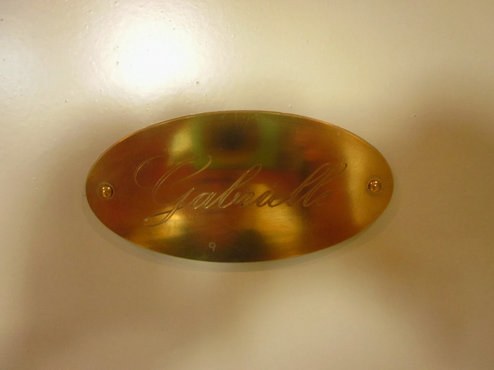
To sweeten the experience, my room bore not a number but my granddaughter's name, Gabrielle.

Our hostess, Marie-Agnes, was very accommodating.  Her dinner was huge:  a beef shank with potatoes, tomato and artichoke heart.  All of that followed a first course of breaded filets of sardine with what the English call "rocket".  Dessert was apple tart and ice cream.  It all hit the spot.

Slept very very soundly in the quiet, dark, elegant room.
Note, please, the hiking gear & clothing awaiting me on the chair.

Saturday, September 28, 2013

Southwest France - to Pont St-Nicolas

The second day's walk began with a very hurried breakfast - Elisabeth doesn't serve it til 9:00 and the taxi was due at 9:30.

We are about to break our fast quickly, so as not to keep the taxi waiting.
Cannot keep waiting the taxi driver who took us to the "hameau" of Russan (a little hamlet, not even a village).  Dropped us off at the town square and delivered our suitcases to our home for the night. This day began with a steep hike up and out of the town and looking down at the Russan Bridge far far below. Oddly, there's water upstream of the bridge, but none downstream.  Apparently during dry spells, there's little water to feed the streams, and the river recedes underground.

The Russan Bridge and the disappearing Gardon River.
This day we walked and walked and walked, sometimes seeing the river below, sometimes the cliffs beneath our feet, and many times glimpsing the cliffs across the gorge. This is pretty dramatic country. The cliffs are quite high, and the landscape is what is called garrigue.
Typical of the Garrigue?  I think so, from what little I could understand.
I don't pretend to understand that word, but the trees are quite small (an oak tree had tiny leaves no bigger than my thumb).  Many of the shrubs have fairly tough and think leaves - kind of like thornless holly leaves.  In some places it was very stark, in others there were grasses, but in many places the garrigue predominated. The trail mostly followed one of the Grand Randonees (well-marked foot trails); this was the GR6 and GR63, with occasional forays along a Petit Randonee.  The GRs are marked by a white stripe above a red stripe, with the PR having a yellow stripe beneath the first two.
Easy to spot the waymarks down low on this scruffy little tree - typical of what we saw in the garrigue.

Cleverly, if the trail turned left, the bars would be underscored by an upsidedown L-shaped arrow pointing left; and vice versa if the trail turned right.  And best of all, if there was a junction with an unwanted or disused trail, the colors crossed in an X shape.
Enlightened Traveller had provided us with very good maps and summaries of each day's twists and turns. We learned to follow carefully the company's notes.  One particular viewpoint was noted in the area, high above a great meander in the waterless river.
This reminded us of a series of meanders on the Potomac River called the PawPaw Bends. 
 When we arrived at this viewpoint, we were not alone - a local man and his lovely Australian Shepherd dog were there. While we ate our lunch, doggie knew what was going on and visited each of us in turn, looking for a hand-out. She was also smart enough to lie down in our shadows, shielded from the sun's heat.
She's a beautiful, friendly but well behaved Australian Shepherd.
A short distance along we were passed by a hunter and his bird-dog.  Seems that bird hunting season had begun.  He wore an yellow cap and his dog an orange collar.
His English was even worse than my Frence.
The worst hiking ever for me had to have been the last kilometer or two before we reached the Pont St-Nicolas.  We were hiking along the high ridge above the gorge (not comfortable for one who doesn't like heights), and the footing is what Enlightened Traveller described as "classic denuded limestone causeway". We called it the swiss cheese rocks.

Take those rocks Pat is sitting on and imagine a long trail carved into it, with holes big enough to snare a toe or a heel. Walking on this stuff was slow, scary, and always with eyes alertly examining the trail.
The best part - rather, the only good part - of this section is the periodic sighting of the bridge in the distance. It was build in mid-13th century with a series of medieval arches.  Before it was built, crossing the Gardon in the rainy season required a long detour to the Pont du Gard but, according to our notes, crossing that over the highest tier was too narrow for mules. This day if there was water in the river, it was hidden by the trees on the right bank.
Actually, we drove across the bridge after our final walk.  We learned then that the great flood of September 2002 had washed out this bridge.  It is so important to transportation that it was quickly and exactly rebuilt.
The hike's end was anticlimactic - - we never got near to the bridge, never crossed it during any of our several days hikes.

The end of this day's hike took us out of the woods and along a local road to a crossroads where we were instructed to phone the owner of the gite for a ride.  But the phone had not been tested up to then for outgoing calls, and great frustration with the instructions was suffered.  Meanwhile, all we could do was sit in the hot sun and hope for relief.  Which came in the form of hiking couple returning to the parked car near to us.  I tried in broken French to explain that we could not call our host and needed some assistance.  What I hoped for was for him to make the phone call.  Instead he offered to drive us to Russan. Of course, we accepted.  Someone showed him the name of our destination; he saw it on a sign at the edge of town and drove us to the gate!!  What a good samaritan.  And we'll never know who he was.

The host is Marc, his wife is Isabelle, and the gite is called Gite des Figouriers, or the Gite of the fig tree owners.  Inside the courtyard is a huge big fig tree.  Made me wish Joe could have seen it.
The house is much larger than what this photo shows.  The rooms were above the two doors seen here, kind of a suite connected by a comfortable bathroom.

Our rooms were pretty comfortable, the dinner was very down-home:  melon with ham, great hot lasagna, and a fruit cup of figs and white peaches, all washed down with Rose wine - which may be a speciality of the region.
Our first course, with wine, of course.

Dessert was white peaches and figs.  I was too hungry to bother photographing the lasagna.

And the dinner was served to us by the owner's daughter, probably about 17 or 18. Maybe she's breaking into the business or maybe she needed to practice her English language skills, or maybe both.  She was very sweet.

This was such a quiet place.  Had there not been a bright light in the courtyard outside my window I'd have left the window open all night in hopes of seeing many stars.

Thursday, September 26, 2013

Southwest France - to Uzes and walking

I'm just back home again, after 20 days in Southwest France.  Why was I there (i.e., why not Paris)?  Well, the city of Toulouse was the site of the World Canals Conference in 2013.  Toulouse is the link between two great canals:  The Canal du Midi and the Canal Lateral de Garonne.  I had cruised upon the Canal du Midi in 2009 with five other women; it connects the Mediterranean Sea westward to Toulouse.  The Lateral I knew nothing about.  Thus they combine to make the Canal of the Two Seas - Mediterranean Sea and Atlantic Ocean.

And because my two hiking/canalling friends and I would be in a new place, I had the brilliant idea to combine two loves of mine: hiking and Roman antiquities, specifically the Pont du Gard, which has stood strong and stunning for 2,000 years.  A company called Enlightened Traveller helped us create a five-day hiking trip that would include the beautiful "water bridge" - the Pont du Gard.  So here begins our hiking trip on September 7.
This wayside exhibit shows, in red, the downward route of the great aqueduct, from its source in the springs of Uzes to the Roman city at Nimes.   
Our hike was not along the route of the aqueduct.  Rather it was along the gorge carved out by the Gardon River.

We made our way to the hill town of Uzes via plane to Paris, TGV to Nimes, and bus to Uzes, a very old city where the ancient Roman aqueduct originated. The original springs still flow, but no longer direct water to the aqueduct.
The original springs still flow, but are now directed into the Alzon River.
Uzes still has several springs, in addition to those that supplied the aqueduct.  Throughout the town were old public fountains, many bearing the legend "Eau Potable" - drinkable water.


This town was a good introduction to medieval France: buildings made of stone or brick, narrow little streets, and very much up and down, with towers and churches and flowers.
St Theodorit Cathedral and the Place de l'Eveche.  The tower is called Tour Fenestrelle.
A narrow little car-free street on the way to the Cathedrale where our hike began.
Our B&B (French = chambres d'hotes), La Maison de La Bourgade, was one or two blocks from the center of town (and the bus stop). Quite a nice place, complete with a swimming pool.  Of course, we headed for it very quickly.  Hmm.  Not heated!  But, as Elisabeth, our hostess said:  "It is quite refreshing". My room overlooked both the courtyard and the street.
You can see the several tables set for breakfast; the chilly pool is just barely visible in the upper right corner.
The town's large "Place aux herbes" is ringed with cafes and shops, with plenty of open space in the center.
Quite a large open square; the arches denote the large open vaulted area, some of which served as cafes and others as shops, with a few being vacant.
We dined there at an open-air cafe called Thierry.  The Place is also the site for the weekly farmer's market, which we visited first thing on Saturday morning.  Not really a true farmer's market (i.e., not producers only), there were charcuterie, poisson, viand, pain, and old clothes for sale.  Quite a busy place.
clearly the domain of the fishmonger; I wish I knew the French word for fishmonger.

the bucherie?  or just a stand where meat was being sold?  

"Ail" is the French word for garlic.  Imagine calling a variety of garlic "Rose du Tarn".  Tarn is the name of a river many miles away.

Between Friday evening (our arrival) and Saturday midday (our first day's walk) we investigated a bit of the town, bought postcards/stamps, and generally got acclimated.  The first day's walk was about 5 miles, down the mountain fairly gradually into the gorge.
This beautiful stone wall is somewhere between "Mas Cazotte" and "Moulin de Carriere".  I'd love to know if the herringbone pattern of the dry-laid stone wall contributes to its stability

Crossing the Alzon River; passing walled homes; investigating a former mill; through a town forest;

and rewarded by a wonderful vista across the gorge to the town and its several towers.
If I'd paid more attention, I could identify the towers; but I'm satisfied with a lovely view.
Then back down into the gorge to follow the path of the old aqueduct (here it was a channel just a few feet wide)
Pat has walked through a tunnel that is a remnant of the 2,000 year old aqueduct while Barbara rests on the stone wall.

Although the aqueduct delivered thousands of liters of drinkable water to the inhabitants of the important city of Nimes, it appears to be quite small, don't you think?
and Northward to the source - the Fontaines d'Eure.
The large sign:  "Eure spring captured by the Romans to supply Nimes drinking water through the aqueduct"
Back at the B&B we tried the pool again - - more "refreshing" than the day before.  As we walked back to the Place for dinner, rain began to fall.  Very intensely falling.
No dining in the square tonight.
We ducked into the nearest likely-looking cafe. There are several in the vaults that formed the ground floor of the surrounding buildings.  It made for a very different kind of dining experience - quite nice to be warm and dry amid the trickle of puddles and the constant rainfall. And the rain tapered off enough for us to scurry back "home" and pack up for a move to the next B & B.

Thursday, September 5, 2013

Leaving . . .

No photographs this time.  Preparing to go to France for 20 days.  And the departure date is here, this afternoon.  A hiking trip of a few days from Uzes to Nimes (including Pont du Gard), then to Sete on the Mediterranean Sea so we can submerge ourselves in that ancient and mysterious and powerful sea. Someone told me yesterday that it's saltier than the ocean we know because of evaporation.  We'll find out.

I've made list and more lists, and yet another list.  In previous years, when I was gainfully employed, I had less time on my hands and so I was much more decisive about what I was going to do, what I was going to pack, and so on and on.  Obsessive is what I've become.  My list of clothing was completely organized in my head; I wrote it all down, gathered it all in one place, packed and repacked the suitcase.  And decided that this was too much.

But I was trying to balance the potential lack of laundry facilities against wearing soiled clothing.  I think the soiled clothing has won.  There's only a four day stretch in one hotel  in Toulouse, and that's during the conference itself - in the middle of my 20 days.  Funny thing about the World Canals Conferences - there are presentations in the morning and then tours in the afternoon, sometimes into the evening.  I believe there might be ONE evening that we are on our own.  That doesn't leave much room for searching out a laundromat (what is the French word for such?  Do they have such?). But I could bring my stretchy clothes line and hope that the maid who cleans the room won't knock any down anything drying there.

Plus there are gadgets that need recharging, which means adapters and converters (space eaters).  And with aging come additional medications (fortunately sorted into little daily compartments) and toiletries, and pretties for dressing up for the "banquet" (vanity, vanity).

One thing I absolutely must do is to find La Poste and mail my hiking clothing back home.  That will make hauling the suitcase easier, and give me a bit of room if there's a souvenir I want to purchase.

My hiking boots are about 12 years old and at the end of their useful life.  The goretex lining has lost its waterproofness. The right-foot boot has a crack in the leather that admits water.  So I shall leave them in some trash container or on the train or something.  (To save space today I'm wearing them rather than packing them.)  So not I just watch the hands on the non-digital clock circle round until Joe and I decide it's time to go.

I will not have electronics on this trip - - no smart phone, no tablet or laptop computer (not that I have one I could bring anyway).  So no more posting until much much later, and then with a lot of photographs (we hope)

Wednesday, August 28, 2013

Fairfield Porter

This is"Penobscot Bay with Peak Island"
How did I grow old never having seen a painting by Fairfield Porter?  I'd heard his name - - someone I knew when I was much much younger called him a great "representationalist" painter, or some thing like that. Not the word "realist", which I might have understood better.

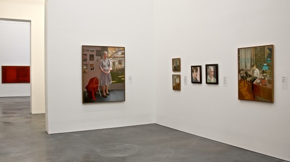
This summer at the Parrish Art Museum on the east end of Long Island had an exhibit of his paintings - - it seems that he lived in Southampton.  And he painted many things there.  Not a lot of detail, but the essence seems to be all there.  And when he died in 1975, his widow gave most of what was in his studio to the Parrish Art Museum.  Including unfinished paintings and some on board; those have never been exhibited. Or so I am told.
Gallery 8 in the Parrish Art Museum is all Porters - this is just a bit of it.
He wrote somewhere:   "The realist thinks he knows ahead of time what reality is, and the abstract artist what art is, but it is in its formality that realist art excels, and the best abstract art communicates an overwhelming sense of reality."

I'll probably now start looking for his paintings everywhere.
This is called "Wild Roses".